This aerial WWII image of the Cambridge University Botanic Garden (above) was taken in 1945, looking from the north towards the south. The allotments in the eastern section (left) and on the Main Lawn (centre) can be seen clearly. Click to zoom in. Cory Lodge is located in the middle of the allotments with a semi-circular drive. Only the western section of the Garden (right) had been developed at this time. The Systematic, or Order Beds are in the oval landscaping (top right) with the lake below right. On the far side of Trumpington Road are rows of air-raid shelters. © Cambridge University Botanic Garden
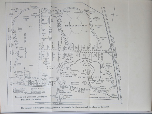
 A colourful illustration of the Cambridge University Botanic Garden, produced by artist, Roger De Simone in 1952, shows the same orientation with the north at the bottom. Maps commonly orientate perspectives with north at the top of the image. It seems likely that De Simone took his inspiration from Humphrey Gilbert-Carter’s guide, published in 1922. Compare Gilbert-Carter’s map (below) and De Simone’s 1952 plan of the western section with the current Garden Map. In order to match the old map and plan, you need to imagine them upside down to the contemporary Garden map. © CUBG
Since the Second World War, the Cambridge University Botanic Garden has been photographed from the air by the University of Cambridge’s Geography Department across the decades. The landscape changes and developments in the Botanic Garden since the 1950s can be followed through a series of photographs across time. These built together to make a fascinating archive of the Garden from an unusual perspective.
The Garden in the 1950s: The Garden in the 1960s: The Garden in the 1970s: The Garden in the 1980s: The Garden in the 1990s: The Garden in 2000s


